
Caricoos
Sargassum Tool
Visualizing Environmental Intelligence Across the Caribbean
Sargassum Tool
Powered by satellite-derived environmental observations, the platform provides near real-time insights into the distribution and intensity of Sargassum blooms, helping researchers, coastal managers, tourism operators, and communities better understand and prepare for changing environmental conditions.
The project focused on transforming complex scientific datasets into an intuitive and accessible digital experience through data visualization, mapping tools, information architecture, and user-centered design.
By combining environmental intelligence, scientific research, and digital systems, the platform helps bridge the gap between data and decision-making, providing stakeholders throughout the region with valuable tools for monitoring, planning, and public awareness.
Project Scope
• Digital Product Design
• Interactive Data Visualization
• Scientific Mapping Tools
• Information Architecture
• User Experience Design
• Environmental Communications
• Research Outreach
• Web Platform Development
Services:
Digital Systems
Scientific Visualization
Information Design
Environmental Communications
Research Outreach


The latest regional outlook indicates that 2026 is shaping up to be another significant Sargassum season across the Caribbean, Gulf of Mexico, and portions of the southeastern United States.
As Sargassum concentrations continue to increase, coastal communities, beach managers, tourism stakeholders, researchers, and the public can benefit from access to localized monitoring tools and forecasts.
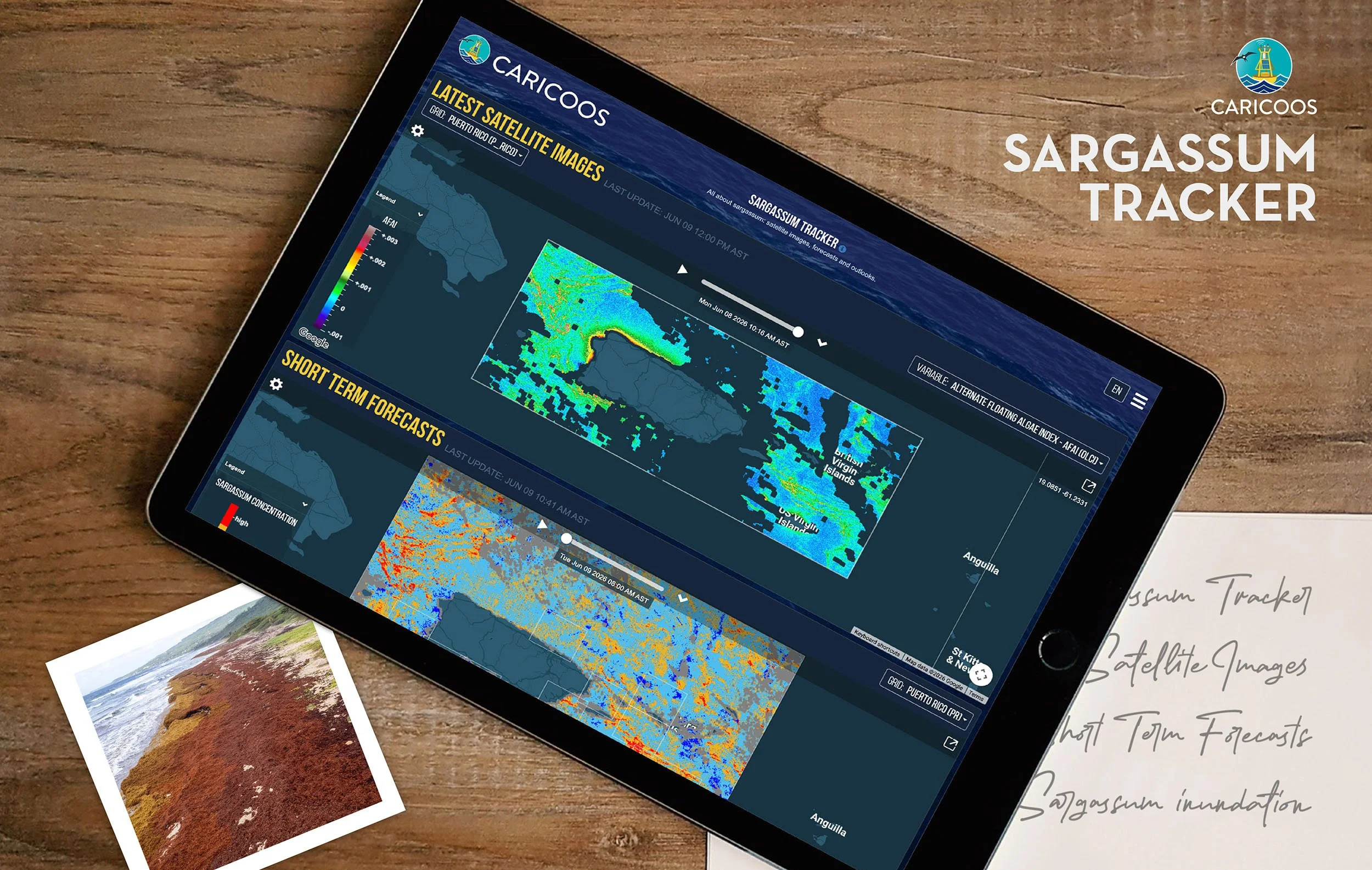
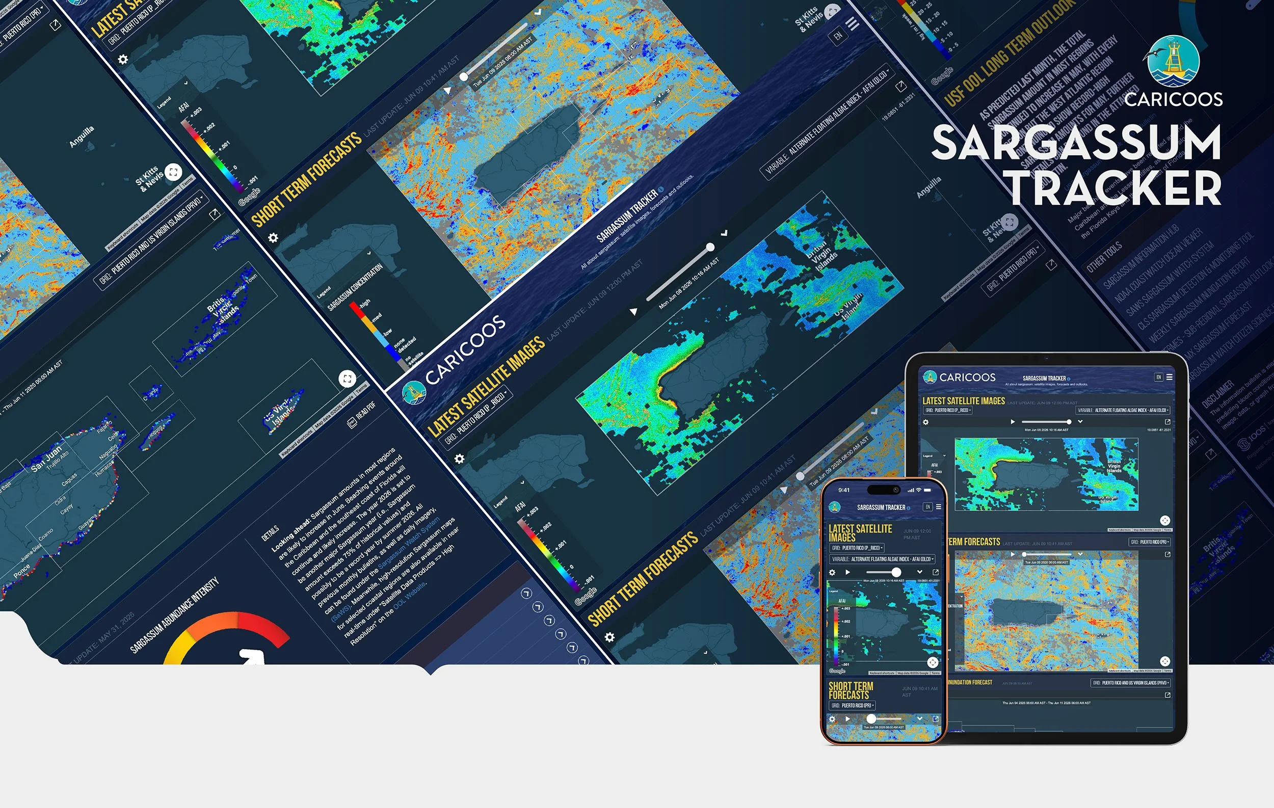
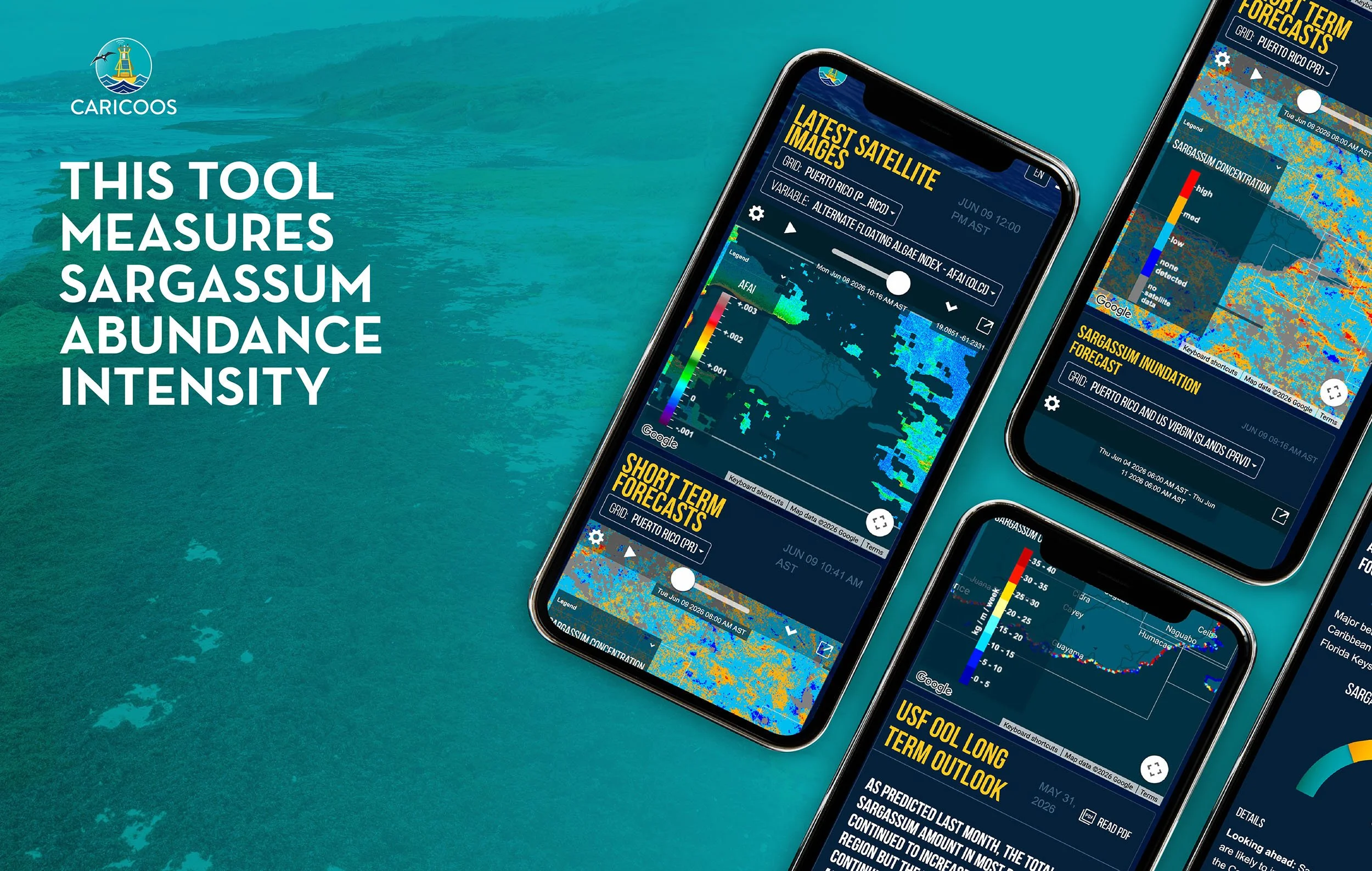
CARICOOS provides a dedicated Sargassum Monitoring and Forecasting Tool designed to help users track conditions across Puerto Rico and the Caribbean region through satellite observations, forecasts, and environmental data.
Explore the CARICOOS Sargassum Tool:
https://www.caricoos.org/sargassum
Original forecast and outlook: